| Instruments |
|---|
 Wind profiler(WPR)

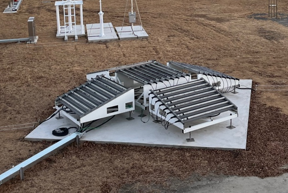
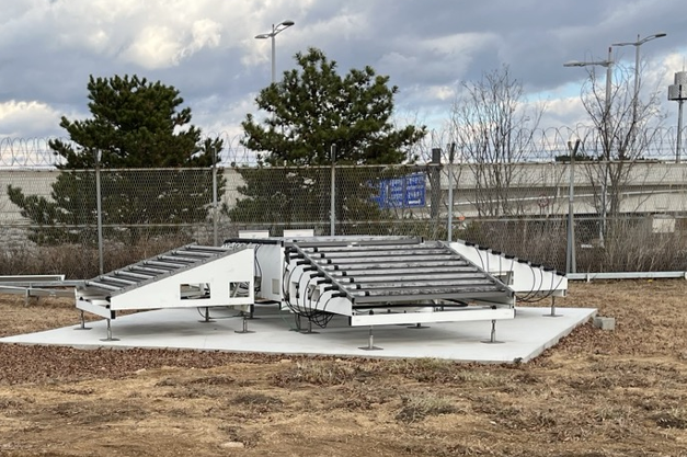
UHF (300~3,000 MHz) radio waves and receives backscattered radio waves by atmospheric turbulence to measure wind and atmospheric conditions from 5 to 10 km from the ground.
| Frequency | 1290MHz (23.26 cm ) |
|---|---|
| Wavelength | 23.26cm |
| Peak Power | 3.5kw(low 200w high 100w) |
| Pulse Width | 2.5㎲ |
| Pulse Repetition Frequency | 10kHz∼20kHz |
| Antenna Diameter | 1651mm × 1651mm 5 array |
| Beam Width | 8° |
| Gain | 27dBi |
| Parameter | Wind direction, Wind speed, Reflectivity, Skewness, Momentum, Vertical/Horizontal vector, Radial velocity |
 Transportable Research X-band Radar(TReX)
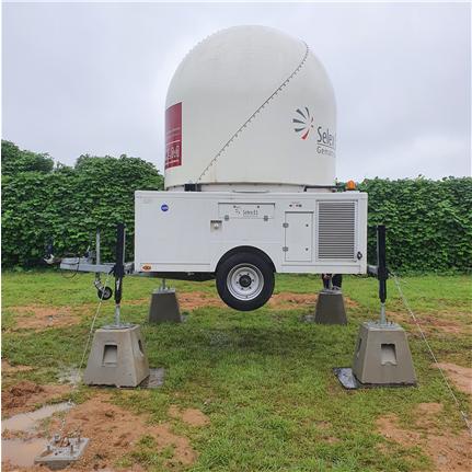
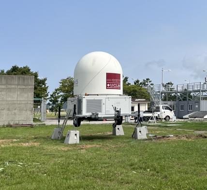
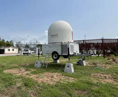
A movable observation X-band radar that emits electromagnetic waves with a frequency of 9300 ~ 9500 MHz in the atmosphere, collides with precipitation particles, and detects the precipitation area, precipitation intensity, and movement speed using the scattered signals.
| Frequency | 9300 ∼ 9500 MHz(X-band) |
|---|---|
| Pulse Width | 0.3 ∼ 3.3㎛ |
| Pulse Repetition Frequency | 250 ∼ 3000 Hz |
| Range | 100 km |
| Maximum Velocity | 96 ms-¹ |
| Antenna Diameter | 1.8m |
| Beam Width | 1.35° |
| Gain | 42.5dBi |
| Total Weight | 3500kg |
| Angular Positionng Accuracy | ±0.05 ° |
| AZ Scanning Speed | 6 rpm |
| Angle Span | 0 ∼ 360 °(azimuth), -6 ∼ 182 °(angle of elevation) |
| Scanning modes | PPI, MPPI, RHI, CAPPI, Pseudo-CAPPI, MCAPPI 등 |
 2-Dimensional Video Disdrometer(2DVD)


Measure the volume, diameter, and flatness of the precipitation entering the observation area (100×100 mm2) with two light sources installed orthogonally and two optical cameras installed on the opposite side, Measuring the vertical fall speed of a precipitation using the height difference (6.2 mm) between the two light sources.
| Horizontal Resolution | 0.18 mm |
|---|---|
| Vertical Resolution | 0.2 mm |
| Observation Area | 100 × 100 ㎟ |
| Operating Temperature | -20°C ~ 50°C |
| Channel | 0.0mm ~ 10.25mm (41 Channel) |
| Weight | 80kg |
| Parameter | Reflectivity, Differencial Reflectivity, Rain Rate, Drop Size Distribution, Shape, Fall velocity |
 Precipitation Occurrence Senor System(POSS)


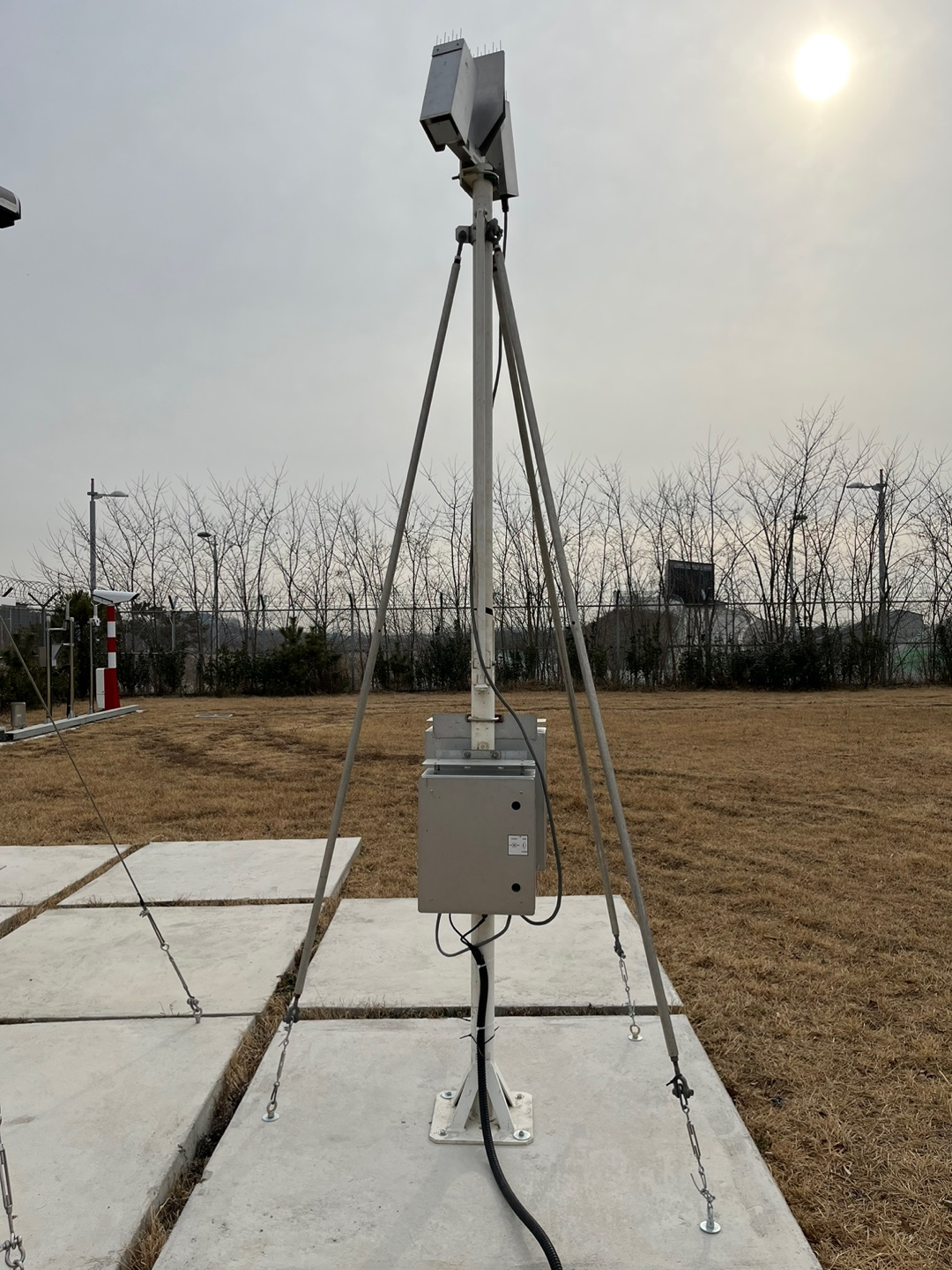
Small X-band Bi-static radar (10.525 GHz) that calculates the drop size distribution of rainfall particles, rainfall intensity, hydrometeor classification, etc. from Doppler power spectral density.
| Frequency | 10.525 GHz ( 2.85 cm ) |
|---|---|
| Sensor | X-band Bi-static |
| Doppler Resolution | 0.23ms-¹ |
| Maximum Velocity | 14.7ms-¹ |
| Sampling Volume | 30㎥ |
| Minimum Detectable Power | -126dBm |
| Parameter | Reflectivity, Rain Rate, Hydorometeor Classification, Fall Velocity, Drop Size Distribution |
 PARticle Size and VELocity(PARSIVEL)


The beam blocking effect of rain or snow particles falling in the laser beam region (wavelength 655 nm) is converted into an electrical signal to measure particle size and falling speed, and to calculate precipitation intensity and hydrometeo classification (rain, snow, hail, etc.)
| Frequency | 650nm |
|---|---|
| Measuring Area | 54㎠ |
| Channel | 32 Channels (Particle Size 0.062mm∼ 24.5mm, Fall Velocity 0.05ms-¹ ∼ 20.8ms-¹) |
| Min./Max. Rain Rate | 0.001 mmh-¹ / 1,200mmh-¹ |
| Operating Temperature | -40°C ~ 70°C |
| Weight | 5kg |
| Parameter | Rain Rate, Hydrometeo Classification, Fall Velocity, Dro Size Distribution, Kinetic Energy, Visiblity |
 Micro Rain Radar(MRR)


Vertically Frequency Modulated Continuous Wave (FMCW) radar that uses electromagnetic waves with a frequency of 24.1 GHz (K-band). Observation of radar reflectivity and particle fall velocity, and calculation of rainfall intensity, liquid water content, and particle size distribution from this
| Frequency | 24.1GHz |
|---|---|
| Wave Length | 1.25cm |
| Spatial Resolution | 10m ~ 200m |
| Maximum Observation Range | 6,000m |
| Antenna Diameter | 60cm |
| Gain | 40.1dB |
| Beam Width | 2° |
| Temporal Resolution | 10s ~ 3600s |
| Parameter | Rain Rate, Reflectivity, Fall Velocity, Drop Size Distribution |
 SOnic Detection And Ranging(SODAR)
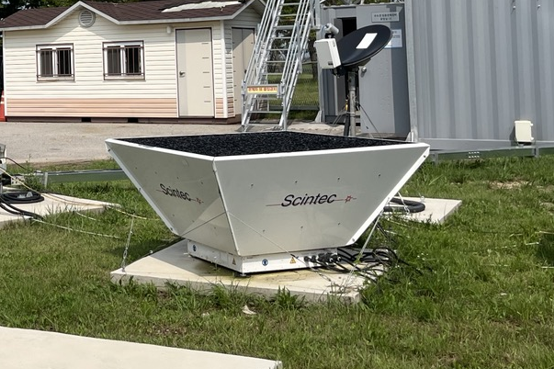


Measure the wind direction and speed of the lower floors using sound waves. Generates sound waves in vertical, north-south, east-west directions from the antenna, receives the scattered reflected waves, acquires frequency change and reflectance data, and calculates the actual wind size and direction by synthesizing the data in each direction into a vector
| No. of Antenna elements | 64 (Phased Array System) |
|---|---|
| Frequency | 1650 ∼ 2750 Hz |
| Beam Angles | 0 °, ±22 °, ±29 ° |
| No. of Range Gates | 100 |
| Vertical Resolution | 10 m |
| Min./Max Height | 30 m / 1000 m |
| Accuracy | Horizontal Wind Speed 0.1 ∼ 0.3 ms-¹ , Vertical Wind Speed 0.03 ∼ 0.1 ms-¹, Wind Direction < 1.5 ° |
| Measuring Range | Horizontal 0 ∼ 50 ms-¹,, Vertical -10 ∼ 10 ms-¹ |
| Operating Temperature | -35 ∼ 55 °C |
| Antenna Size | 74 x 72 x 20 cm |
 Multi-Sensor for Weather Observation(Model Name: WXT530)
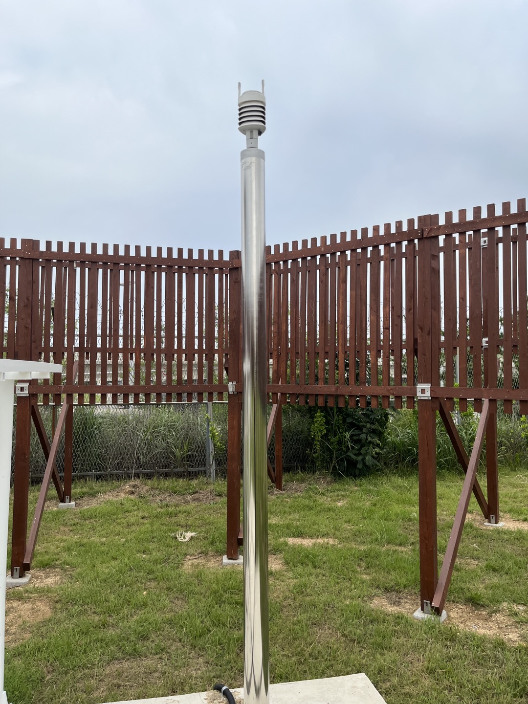
provides 6 of the most important weather parameters: air pressure, temperature, humidity, rainfall, wind speed and direction through various combinations.
| Measuring Range | Pressure 600 ∼ 1100 hPa, Temperature -52 ∼ 60 °C Humidity 0 ∼ 100 %, Precipitation 0 ∼ 200mmh-¹ Wind Direction 0 ∼ 360°, Wind Speed 0 ∼ 60 ms-¹ |
|---|---|
| Resolution | Pressure 0.1 hPa, Temperature : 0.1 °C Humidity 0.1 %, Precipitation 0.1 mmh-¹ Wind Direction 1°, Wind Speed 0.1 ms-¹ |
| Accuracy | Pressure ±0.5 hPa (0∼30°C) , Temperature ±0.3°C Humidity ±3% (0∼90RH), ±5% (90∼100RH), Precipitation 5% Wind Direction ±3°, Wind Speed : ±3% (10 ms-¹) |
| Operating Temperature | -52 ∼ 60 °C |
 3D Sonic Anemomter

Measure wind speed components and air temperature by transmitting and receiving sound wave signals in fixed orthogonal directions of X, Y, and Z axes.
| Measuring Range | Wind Direction 0 ∼ 359°, Wind Speed 0 ∼ 30 ms-¹ Temperature -50 ∼ 70 °C |
|---|---|
| Resolution | Wind Direction 0.1°, Wind Speed 0.01ms-¹ Temperature 0.01 °C, Temporal Resolution 1 ∼ 10 Hz |
| Accuracy | Wind Direction 0.1 °, Wind Speed 0.01 ms-¹ Temperature 0.1 or 0.05 °C |
| Operating Temperature | -50 ∼ 70 °C |
| Parameter | Wind Speed(x, y, z Components), Temperature |
 Weighing type Raingauge(Model Name: PLUVIO)


The vibration wire sensor continuously measures the weight of the rain collected in the bucket through the top of the water spout and outputs the frequency. Since the frequency is a function of the tension applied to the wire, it is converted into rainfall to calculate the accumulated rainfall.
| Amount | (ver.200) 1500mm , (ver.400) 750mm |
|---|---|
| Resolution | 0.01mm |
| Interface | RS-485 |
| Operating Temperature | -40 ~ 60°C |
| Weight | 16.0kg |
| Parameter | Accumulated Precipitation, Rain Rate, Temperature |
 WindLidar
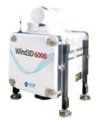
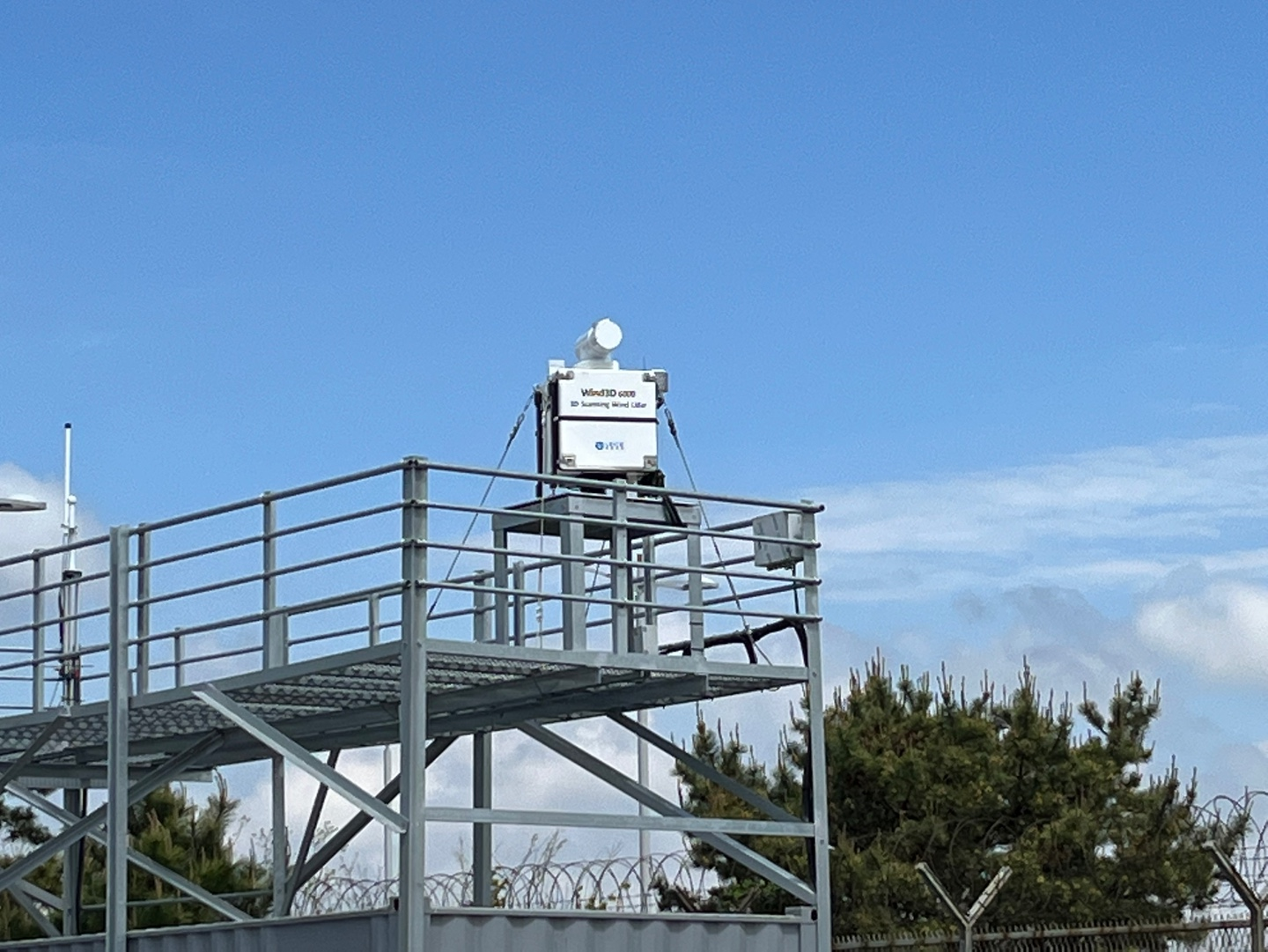

High-resolution three-dimensional wind field observation by transmitting a laser (wavelength 1550 nm) to measure the Doppler shift of the backscattered wavelength.
| Wave Length | 1550 nm |
|---|---|
| Nyquist Velocity | -37.5 ms-¹ ∼ +37.5 ms-¹ |
| Spatial Resolution | 15 m / 30 m / 60 m / 150 m (User Selectable) |
| Accuracy | Wind Direction ±5°, Wind Speed ±0.5 ms-¹ |
| Detection Range | 45 m ∼ 6000 m |
| Scanning Modes | LOS / DBS / VAD / PPI / RHI / CAPPI |
| Parameter | Aerosol back-scatter profile, Wind Direction, Wind Speed |
 Ultrasonic Anemometer(Model Name: USA-1)


System uses ultrasonic pulses along three non-complanar ray paths to measure wind speed and wind direction or alternatively the three orthogonal windcomponents x, y, z.
| Measuring Range | Wind Components –50 ~ 50 ms-¹ Wind Direction 0 ~ 360° Temperature –30 ~ 50 ℃ |
|---|---|
| Resolution | Wind Components 0.01 ms-¹ Wind Direction 0.4 Temperature 0.01 K Time Resolution 0.004 ~ 25 Hz |
| Parameter | x,y,z Wind Components, Temperature |
 Meteorological Particle Spectrometer(Model Name: MPS)


The Meteorological Particle Spectrometer (MPS) is designed to directly measure precipitation shapes, sizes and fall velocities. In post processing, rainfall rates and statistical data on the intensity of the rainfall can be derived. The image data can be analyzed to determine if the precipitation is in the form of droplets or frozen precipitation.
| Technique | Optical Array Imaging (64 element: 62 sizing elements, end diodes reject) |
|---|---|
| Arm Width | 200 mm |
| Sampling Frequency | 660 nm, <30mW |
| Data System Interface | 1-D histogram data, housekeeping data, and instrument control: RS-422 at 57, 600 baud 2-D image data : RS-422 at 460,800 baud |
| Operating Temperature | -40 ~ 40 ℃ |
| Humidity | 0 ~ 100 % |
| Power Requirements | AC input (115/230VAC), 50-60Hz, 300W |
| Weight | 21.8 Kg |
| Parameter | Rain Rate, Fall Velocity, Reflectivity, Drop Size Distribution |
 GEONOR
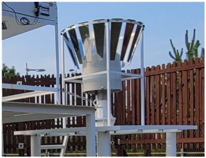
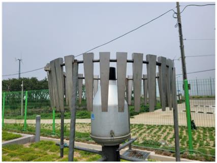
The Geonor is designed for year round, automatic precipitation measurements. Sensors are available in 600 mm, 1000 mm, and 1500 mm capacities. Vibrating wire transducers (sensors) are used to measure total precipitation and rate of precipitation. Each capacity of gauge is able to use 1 or 3 sensors. Using more than one sensor ensures redundancy in data collection. Precipitation can be reported at real-time intensity to any interval required. The precipitation sensor is simple to configure for use with automatic data acquisition units. Because of its simplicity and low power requirement, the Geonor is well suited for remote locations where power may only be available from solar energy. The Geonor requires a pedestal, wind screen, and conductor interface cables, which are available separately. The Geonor was developed in Norway and has a long-standing history of operation. There are more than 2000 systems installed worldwide, with applications in national weather services, climatic research institutes, hydro power companies, airport authorities, road authorities, agricultural services, avalanche prediction centres, and winter sport resorts.
| Capacity | 600mm, 1000mm, 1500mm |
|---|---|
| Collection Area | 200cm2 |
| Sensitivity | 0.05mm (600mm), 0.075mm (1000mm), 0.1mm (1500mm) |
| Accuracy | 0.1% full scale |
| Repeatability | 0.1mm (600mm), 0.1mm (1000mm), 0.15mm (1500mm) |
| Power Draw | 3.4mA per vibrating wire ,6-7mA on warm-up |
| Operating Range | -40q to +60qC |
| Temperature Drift | 0.001%FS/°C |
| Materials | Aluminum alloy |
| Dimensions | Ø = 390mm; H = 760mm (600mm),
Ø = 390mm; H = 800mm (1000mm), Ø = 390mm; H = 1000mm (1500mm) |
| Mounting | Universal 3-point with leveling system incorporated in base |
| Maximum Cable Length | 1 km |
| Compatibility Dataloggers | CR200(X) series, CR800 series, CR1000,
CR3000, CR5000, CR510, CR10(X), CR23X |
 VertiX (Vertically pointing X-band radar)
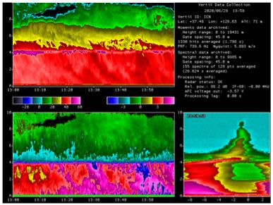
VertiX is made by remodeling of transmitter-receiver of a ship radar with a parabolic antenna and a locally developed data collection system (McGill university).
The radar can observe reflectivity and doppler velocity of only vertical direction. All precipitation targets, some ice clouds can be detected.
| Peak power | 23 kW |
|---|---|
| Wavelength | 3.2 cm |
| Antenna size | 1.2 |
| Beamwidth | 1.8 |
| Time resolution | 2 sec. |
| Vertical resolution | 45 m |
| Observation range | ~10 km |
| Observed variable | Z, Vr |
 Rain gauge (Tipping bucket)
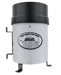
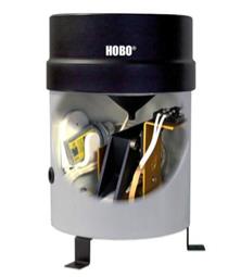
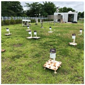
A battery-powered rainfall data collection and recording system that includes a HOBO Pendant Event data logger integrated into a tipping-bucket rain gauge.
| Maximum Rainfall Rate | 12.7 cm (5 in.) per hour |
|---|---|
| Calibration Accuracy | +1.0% (up to 2 cm per hour for the RG3-M or up to 1 in. per hour for the RG3) |
| Resolution | 0.2 mm (RG3-M) or 0.01 in. (RG3) |
| Calibration | Requires annual field calibration, see Field Calibration section |
| Operating Temperature Range | 0° to 50°C (32° to 122°F) |
| Storage Temperature Range | -20° to 70°C (-4° to 158°F) |
| Environmental Rating | Weatherproof |
| Housing | 15.24 cm (6 in.) aluminum collector and base |
| Tipping-bucket Mechanism | Stainless steel shaft with brass bearings |
| Dimensions | 25.72 cm height x 15.24 cm diameter (10.125 x 6 in.); 15.39 cm (6.06 in.) receiving orifice |
| Weight | 1.2 Kg (2.5 lbs) |
| Part Numbers | RG3 (0.01 in. per tip) RG3-M (0.2 mm per tip) |
 Ka-band Cloud Radar
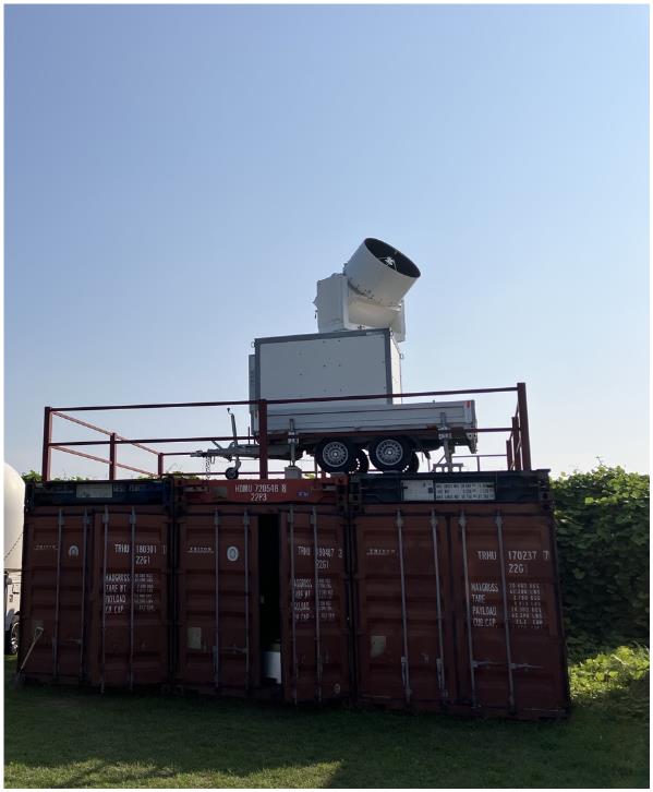
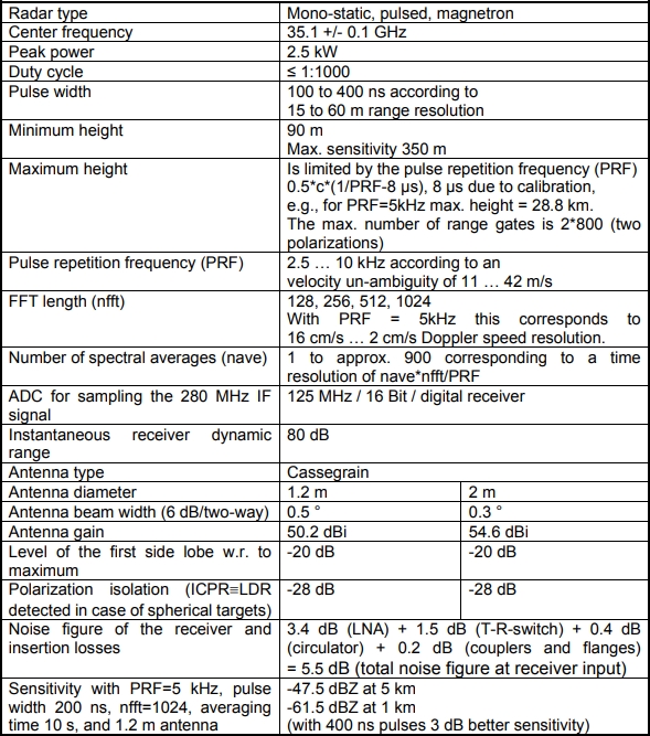
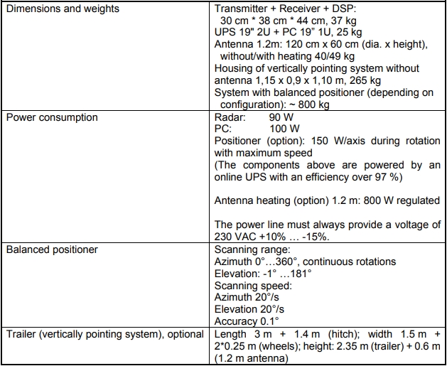
MIRA-35C is a magnetron based pulsed Ka-Band Doppler radar with very high sensitivity, which allows detecting atmospheric clouds and fog.
It transmits a linear polarized signal while receiving co- and cross- polarized signals simultaneously to detect Doppler spectra of reflectivity and Linear De-polarization Ratio (LDR).
The reflectivity is used to determine the density of cloud constituents while LDR helps to identify the target type.
 LMA (Lightning Mapping Array)
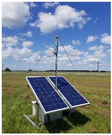
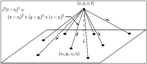
The 5th generation LMA is a three dimensional lightning mapping array which consists of several individual LMA sensors arranged around a target area. The spacing of the sensors is dependent on the size of the area to be covered, the topography of the area, the importance of locating ground strikes, and the number of sensors in the network. Each sensor consists of a VHF antenna and receiver, a GPS antenna and receiver, a cellular antenna for communication, and solar panels with batteries to provide operational power. A network usually consists of 12 to 15 individual LMA sensors and a central processing server. The network is generally self-sufficient, although periodic maintenance is required.
| Measurements | Location, time and structure of total lightning (Intra-cloud, cloud-to-cloud and cloud-to-ground) |
|---|---|
| Spatial Resolution | Horizontal(6 - 12m), Vertical(20 - 30m) |
| Temporal Resolution | Per lightning event |
| Accuracy | >95% within 100 km of network |
 Double Fence Intercomparison Reference(DFIR)
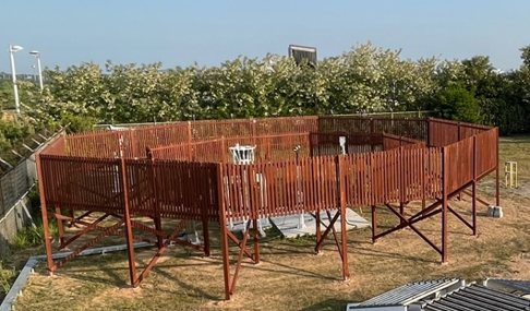
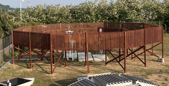

It is a large double fence made to the standard specified(inner & outer fence height) by the WMO to minimize the influence of the surrounding wind and increase the precipitation capture rate.
Cross section of Double Fence Intercomparison Reference (DFIR)


 Login
Login 
